Wednesday, May 30, 2012

Bilagi Heritage Trip - Part (1)

I visited Bilagi (Svetapura) village in few months back with my friend RajeshNaik & Sunil Kamath. It’s a small and beautiful village which reflects unique elements of Hindu and Jain influence over the span of generations. A casual glance at the rich historical past of this village is enough to recognize the significance of the place. I wasn’t very excited because I had no idea what I will expect to see, normally I won’t ask much details about our destinations with Rajesh Sir, every time each destination will be big surprise for me so when we got there, first of all I was extremely beyond excited.
Bilagi Village has some beautiful Hindu and 
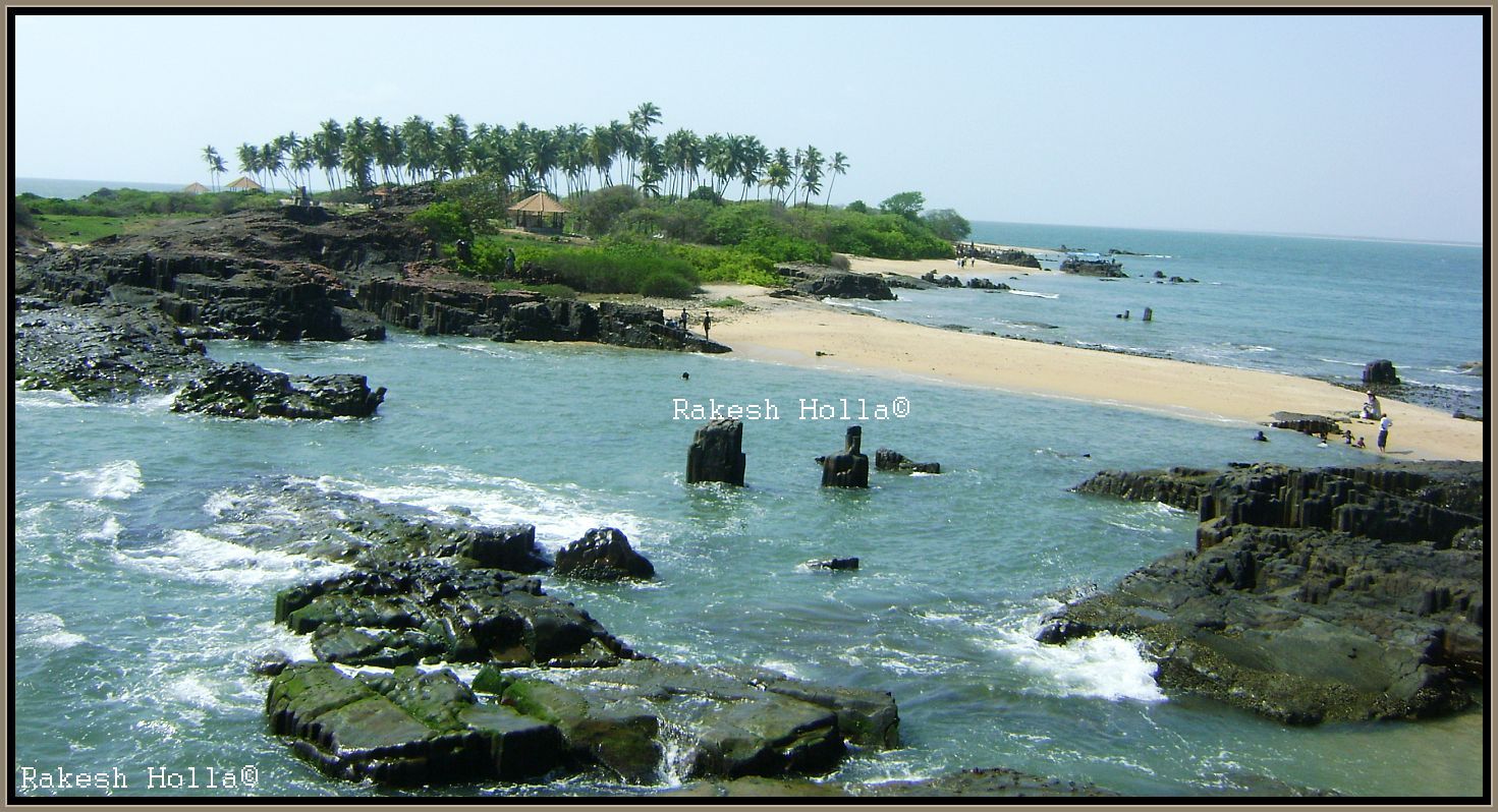
Jain temples and monuments. First we went Gola Baavi a huge square shaped well sprawled on just few meters from Bilagi circle is a place of immense importance to Heritage lovers. As soon as we went inside, I quickly took out my camera and started taking pictures. It was so magical. The weather was perfect, the sun was setting, and absolutely breathtaking view.
 On the eastern side there was a small underground passage which lay down to a small squared shape corridor. A deep well and a pond with flight of steps are there inside the fort. The beauty of this well is that it is entirely made of bricks and the brick work can be seen inside the entire inner wall of the well very beautifully. However, there is no one is using this water for quite sometime now. The well was built by Bilagi Chiefs in scientifically considering natural interferences like rain & wind.
 I was wishing to stay there longer. Since it was getting late we had to leave for next place. Later we headed to explore Virupaksha Temple which situated just interior part of the village. As per the inscription this temple is dated to 1570 A.D. by Queen Virambika. There is an inscription on the slab in the Virupaksha temple which records the construction of the temple along with Shikhara, Prakara, Mantapa, etc.

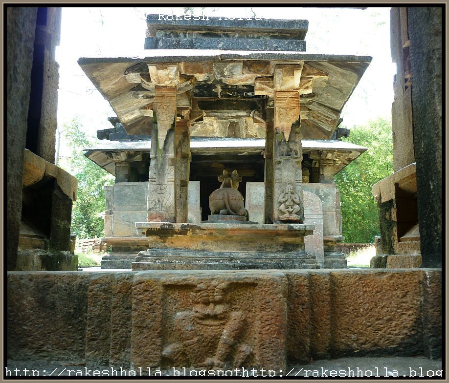
This temple is built in Vijayanagara style and has a Garbhagriha, Navaranga, a separate Nandimandapa and a Mukhamandapa. The Pradhakshinapatha around the Garbhagriha is enclosed and there are pierced windows on the either side of the Garbhagriha. One of the windows has Mahishamardini motif.
 There are images of Ganapati and Mahishmardini on either side of the entrance of the Garbhagriha. Apart from the big Nandimandapa, the Mukhamandapa has many impressive carvings in relief.

Wednesday, May 23, 2012

Tonsepar - Palm Island

Being away from the boring routine to feel calm and happy, the perfect combination of beauty and serenity is Coconut Island, you feel free, free to fly, to enjoy the life in perfect place. There is something about the sea, that is calming and soothing to the nerves and there is something very romantic about being on an island. I think it’s the feeling of being disconnected from the rest of the world that really feels special. Running around the island, embrace the cool air; lay on the sand, kissing the white fluffs of froth, having appreciated sun-down sight over the palms, My God, everything’s so lovely all of these make way to maybe the happiest people in the world on that moment.
‘Tonsepar Dweepa’ is being called as St Mary’s Island also known as Coconut (palm) Island is a small uninhabited island in the northernmost island in the Arabian Sea. It’s situated 8 km north of Malpe cost. This picturesque island was formed out of lava that erupted from the bottom of the Arabian Sea millions of years ago and it’s famous for its basalt rock formations (We studied in geology three varieties of rock formations -basalt, granite and sandstone) in a hexagonal form the only one of its type in India. The rocks on the island have crystallized into columns split into a hexagonal mosaic the rocks presented us with different colors of rock formations here with great picturesque view.
Coconut palms adorn the island. The island provides a great backdrop for some good photographs. The scenery that captures the eyes is that of perfect coconut trees, the rocks and the sea that we drew at art class in school. The Geological Survey of India declared it a National Geological Monument in 1979. It is said that the Portuguese traveler Vasco Da Gama landed on this island in 1498 and named it El Pardon De Santa Maria.
A set of four small islands (Coconut Island, North Island, Daryabahadurgarh Island and South Island) the north-south aligned islands form a non-continuous chain. The island covers an area which is about 500m in length with a width of 100m. It has prominent coconut trees, its cover reflecting in an azure south sea color.
Two regular small Ferris’s will bring tourists from Malpe natural fishing harbor to the island and has to switch to small boat just few meters away from the island. The journey was always pleasant with scenic view; the feel of the rough sea that made the boat to have rhythmic dumps had its own music. The thought that we were away from all the hustle and bustle of the city gave us a reason to sport a permanent smile on our faces.
Some shelters have been built on the island for tourists. The western coasts of the islands are a seashell haven with seashells of various shapes and sizes littered along the coast. Its idyllic black polished rocks that frame its coast. There are no safe sand beaches to swim and relax since it is scatted with basaltic rocks but I always prefer to freshen up, take bath and have fun in small beaches between these rocks situated in Northern and southern part where less crowded.
 Here we can see some clean beaches where the seaside soft sand scratching and tickles under bare feet and the water touches with tender. A perfect corner for bathing the huge waves are stop by colorful rocks which can see the reflection of the sun. I like to see the white froth on top of the overflowing waves. Whenever we taking bath here the sun rays playing pet our naked bodies by happily and smilingly we jumped into the water, playing with great fun, chasing playfully each others, splashing water all around and finishing with put down our exhausting bodies on the sand.
We never realized how time flew staring at the sea. What could be more beautiful than to be on an island, sit by the sea and watch the sun go down it was time to wrap up all the good times and take them back as memories forever on the ride back we always kept our self silent thinking of the time that we spent mesmerized in nature's resplendent beauty. Endless Ocean that seems to merge with the horizon, so that it’s hard to understand where is the end of the water and the beginning of the sky. You are on your own in that Paradise corner away from the noisy and hectic crowd.
Island sunset View from my home (Tottam) beach

Saturday, May 19, 2012

Madhugiri Fort - Hillocks galore (2)

 Later at mid-noon we headed to the next level. Our next trail became more steeper and dry. Climbing the huge boulders was tiring and few places it’s very deep too, an awesome hike we reached middle part of the fortress. I was tired and hot and felt my tummy saying hungry. It was a stunning adventure to do just having half liter water without any food at mid-noon is at it challenging, although also at its loveliest.
 Round and round went my feet, and for each several revolutions the elevation would gain another foot or two. Soon I was gasping, and then resting. The view down to my surroundings grew more and more panoramic and after a hard attempt we reached top at 3pm. I did feel some small sense of accomplishment at having made it, but I was too weary at the time to appreciate it much.
 We had shared last drop of water on top, and then began the walk along the cliffs up towards the north, where there was rest of an ancient castle. I admired the view while ascended to the slightly higher view from the top. A 360 degrees panoramic picture will add to the spectacular view of the fort.
History:
The original construction of the fort can be attributed to The Ganga Dynasty. They were great builders and had built a number of temples all over Karnataka. Before the fort could be completed they were overthrown by Nolamba dynasty. The Reign of Nolamba dynasty lasted a short time before they were defeated by Vijaynagar Empire.
An interesting incident prompted the Gowda family to considering building a fortress. A stray sheep went missing around the Madhugiri hillock only to return late in the night dripping with water. This was music to the ears since a spring would definitely be welcome sign for rain deficient area. A decision to construct a fortress was arrived and the task was completed. The Gowdas started ruling this region based at Madhugiri Fort. Genesis of the name Madhugiri is derived from the Honeybee colonies which were prevalent in those days towards the northern parts of the Madhugiri fortress.
In 1678, The Gowda’s got into a disagreement with the Wadiyars of Mysore over non submission of revenue collected being feudatory. The Devaraja of Dalavoy dynasty, who was the commanders under Wodeyar’s of Mysore soon invaded the fort and captured it. However the Gowda’s on agreeing to part with the tax were restored their title and fort. The Maratha’s invaded the territory and captured the fort. They held the fort for 7 years before they were defeated by Hyder Ali in year 1764.
 Hyder Ali ordered the restoration of the mud fort by building huge arches and watch towers. The highlight of the new fort after the restoration was the huge circular granaries which were used to store Ragi, oil and ghee. After the death of Tipu Sultan in 1799 the British manned the fort for a brief period and used the premises to jail the mutineers in 1857.  Since the Fort was built in an impregnable manner, it served as barracks and prison.
Final Stage of the Fort...
We find one small pond on top of the hill but water was not drinkable its filled with plastics and junks, I can’t say this enough but keep in mind that we are spoiling the beauty of the place by leaving our junk everywhere we stop. We find few places people spoiled the walls to write their name rubbish things on the walls. A lot of the natural historical beauty has been destroyed like such foolish activities by uncivilized humans.
 The surroundings of Madhugiri are dotted with several hills like Anandarayana Betta, Midigeshi durga and Bhasmangi Betta. The nearby popular trekking rocks Siddarabetta and Chennarayanadurga, now part of Koratagere taluk, were once part of Madhugiri.
 Siddeshwara Gavi, Pataladammana Gavi, Meke Gavi and Saddhu Gavi are the cave rocks located at the foothill of Bolibetta. Bolibetta hillock is near Chikka Madhugiri Betta on the outskirts of Madhugiri.
I could see the many birds soaring near the cliff face on the updrafts of air that must have been present. It was quite a sight.  I wouldn’t like to stay very long on the peak, but it was also time to be on our way back, after an enjoyable time on top we turned down, and went down a steep hill passing by the same rout coming down the hill is fairly quick. 
At the bottom of the hill we came to the town as usual, it was a puzzle finding something that could serve as lunch, but we had seasonal Mango juice 4 cups each so this was the end of our wonderful adventure.